In July 2012 my friend Dylan Johnson and I made an 11-day road-trip through interior BC, and although we climbed several fun things, the highlight for me was the Northwest Arête of Mt. Sir Donald. Although I had driven through Rogers Pass many times, I had never climbed there previously, and I knew so little about the area that we found route information only from Google searches the afternoon beforehand. The Northwest Arête is technically quite moderate, mostly 4th class with a few sections of low 5th, but it is “The Nose” of moderate alpine ridges – it gains about 800m of vertical on technical terrain, and is consistently exposed, on excellent quartzite, with amazing scenery. I honestly think it’s one of the finest alpine climbs on the continent, and it certainly opened my eyes to the quality climbing at Rogers Pass. Thus, when I saw David P. Jones’ new guidebook to Rogers Pass last year, I had no hesitation buying it. The cover of the new guidebook is a photo of the north face of Sir Donald, and it showed a very obvious, unclimbed gully/gash that looked like it would make a nice snow/ice/mixed route. Dylan and I briefly planned to try it last spring, but unsure if the weather and conditions were good enough, we didn’t gamble on the long drive and ended up rock climbing in Squamish instead.
Last week my girlfriend, Sarah Hart, had to drive around interior BC and out to Canmore for her work, and I came along to keep her company, with the plan to tag on some climbing together as well. We brought all sorts of climbing gear to keep our options open, but Plan A was the unclimbed gash on Sir Donald. Spending the first three days of the trip just driving around BC in the rain with no physical activity wasn’t so awesome, but at least we got to do it in her deluxe work-supplied Sprinter van. After her work duties were finished the weather improved, so we drove up to Rogers Pass for a crack at Plan A.
On June 17 we hiked up the Asulkan Brook Valley to a bivy at the Uto – Sir Donald col, first on mostly dry ground, and then nearly entirely on snow. On the 18th we woke up very early and left our bivy around 2:30am, downclimbing to the Uto Glacier, and then traversing to the base of our line. So near to the solstice there had been only about 4 hours of darkness and the snow wasn’t nearly as re-frozen as I had hoped, but just barely enough.
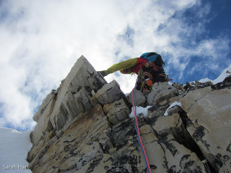
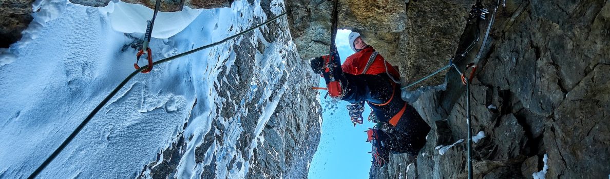
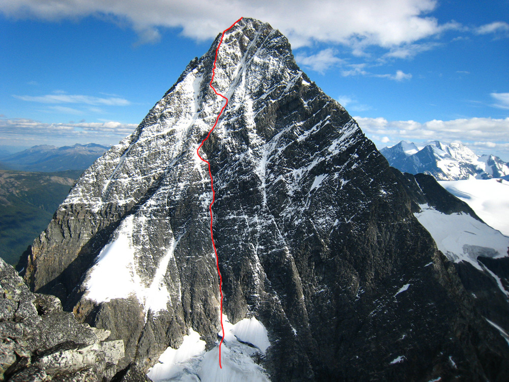
We climbed the route relatively quickly, mostly because we were concerned that in the afternoon there might be ice or rock fall on the face. The route follows a very obvious, straight couloir for the first half, and then goes part-way up an obvious ramp/gash, before branching left onto a mixed rib near the end, and finally joining the Northeast Buttress route. I’d estimate that we simul-climbed about 75% of the route, and pitched out the rest. We climbed one distinct crux pitch, which was M5R, although I’m almost even tempted to say M5/6R. From below it looked like a very easy step of AI3, but turned out to be much more difficult up close. However, this pitch could have been easily avoided via easier terrain further to the left, and we would have gone left if the pitch didn’t look so easy from below. Most of the climbing was 60 degree snow/ice/neve, with an occasional step of 70-85 degree ice, and lots of sections of easy, M4ish mixed climbing on good quartzite. So, the route was quite easy from a technical standpoint, and in hindsight I’m sure I would’ve been comfortable free-soloing it, but it is decently long (850-900m total vertical gain, the last 75m on an existing route), and a face which wouldn’t be trivial to descend.
We had no set plan for the descent, and we figured that during the climb we would choose between rappelling our route, descending the Northwest Arête or descending the South Ridge. On the way up good protection was often difficult to find and we developed a sense of how large the face is, and thus soon ruled out descending our route. The Northwest Arête can be a quick descent in summer (Dylan and I free-solo down-climbed the route in our approach shoes, partly in the rain), but covered in snow it looked like it would be a very long, tricky descent. So, after a short break to relax on the summit, we started down the South Ridge. All in all I think our choice of descent was the right one, as we were able to lose much more elevation by down-climbing than by rappelling, but any descent off of Sir Donald is a long endeavor, and it was past 6pm when we finally took our harnesses off in the basin below Sir Donald’s west face. Sarah carried our climbing gear down to the dry trail, while I hoofed back up to the Uto – Sir Donald col to retrieve our bivy gear, and then we hiked out to the car, yelling obscenities into the pristine, deserted valley to let the bears know that we were two badass mofo’s not to be messed with, and that we would perform degrading sexual acts to them if they charged us.
We named our route “Sashimi Don,” (850-900m, 60-85 degrees, M4) after my favorite dish at Squamish’s Kozo Cafe. While it will never be the ultra-classic, highly-recommended Northwest Arête, it is a logical route on a grand face. Conditions were neither amazing nor terrible for us, and I suspect that finding good conditions will always be the trickiest aspect of repeating it.